Zagorje routes
Results: 23
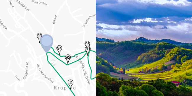
Circular Country Route
Among the cycling routes of county significance the most important place holds the Circular county route that connects all four routes of the state significance and both cross-border routes, and with its 163 kilometres it is the longest route in the Krapina-Zagorje County.
Range Zagorske županijske rute |
Length 165km |
Difficulty 5/5 |
Elevation 3600m |
Surface Pretežno asfalt |
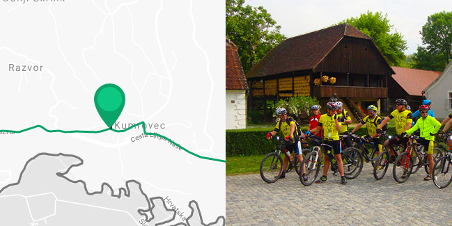
Following the Paths of Croatian nobles
This cycling route leads through the valuable historical localities, characteristic for the Zagorje region. The route begins in the center of Kumrovec, hometown of the world famous statesman, marshal Josip Broz Tito.
Range Zagorske županijske rute |
Length 49km |
Difficulty 3/5 |
Elevation 480m |
Surface 100% asfalt |
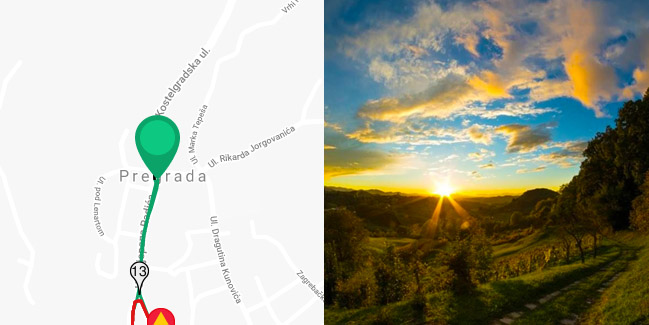
Unforgettable Views from Vinagora
This route will take you down the asphalted road that winds between houses, vineyards and orchards to one of the most beautiful views of Zagorje (to the west from Pregrada) – Vinagora (407 MSL), with the church of the Visitation of the Blessed Virgin Mary, through idyllic and charming hills and through the lowland areas of the county.
Range Zagorske županijske rute |
Length 37km |
Difficulty 4/5 |
Elevation 700m |
Surface 100% asfalt |
Through the Scenery of playful Hills
This short cycling route will take you through the outermost northwestern part of the Krapina-Zagorje County, known for its 140-year-old tradition of glass making, the Municipality of Hum na Sutli.
Range Zagorske županijske rute |
Length 15km |
Difficulty 2/5 |
Elevation 220m |
Surface 100% asfalt |
Route of Belvederes
This cycling route is full of vantage points, which can be reached through stronger and steeper ascents, so it is somewhat difficult. Because of the difficulty of ascent, but also because of its beauty, especially notable is the belvedere of the green and forested Kunagora (522 m) above Pregrada, known for dag pistol shooters and tradition of the Easter dag pistol shootings.
Range Zagorske županijske rute |
Length 33km |
Difficulty 4/5 |
Elevation 740m |
Surface 100% asfalt |
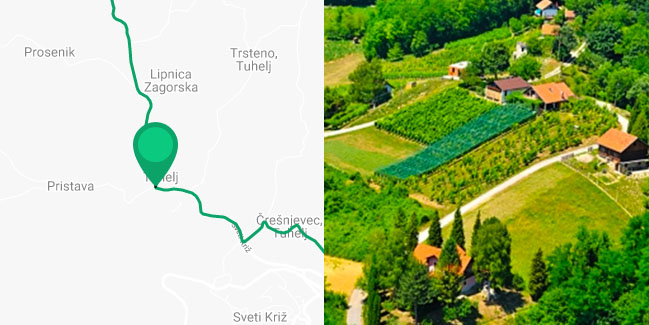
Following the Hot Springs
This route goes over a more flat terrain, with less ascents and it is more suitable for lighter, recreational ride through two beautiful valleys and famous spa resorts of Zagorje.
Range Zagorske županijske rute |
Length 38km |
Difficulty 2/5 |
Elevation 260m |
Surface 100% asfalt |
Following the Historical paths of the Krapina Neanderthal man
The beauty of this cycling route is that it leads you through historical and natural beauties of Krapina surroundings and the middle part of Zagorje.
Range Zagorske županijske rute |
Length 30km |
Difficulty 3/5 |
Elevation 460m |
Surface 100% asfalt |
Over the Slopes of the Mountain Macelj
The beauty of each cycling route is the opportunity to experience a certain area to the fullest. This cycling route will take you through the northern part of the Krapina-Zagorje County and partially through the neighboring Varaždin County.
Range Zagorske županijske rute |
Length 38km |
Difficulty 3/5 |
Elevation 470m |
Surface 100% asfalt |
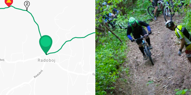
Over the Slopes of Strahinjčica
This cycling route, which leads through the surroundings of Radoboj and Gornje Jesenje, is full of preserved nature and beautiful landscapes, so characteristic for Zagorje – interwoven series of green hills and valleys.
Range Zagorske županijske rute |
Length 23km |
Difficulty 3/5 |
Elevation 600m |
Surface 100% asfalt |
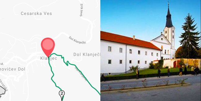
Route Towards Klanjec and the Valley ot the river Sutla
This medium-long route will take you through the valley of the river Sutla and southwestern Zagorje and it will connect you with the network of cycling routes in Zagreb County.
Range Zagorske županijske rute |
Length 41km |
Difficulty 3/5 |
Elevation 480m |
Surface 100% asfalt |
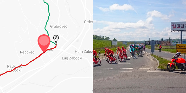
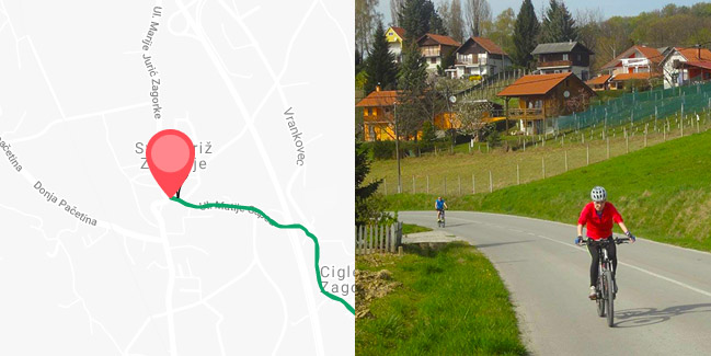
Through the Surroundings of Zabok and Sv. Križ Začertje
This beautiful cycling route will take you through the area of Zabok and Sv. Križ Začretje. The route begins in the center of Zabok and continues towards northeast, to the intersection, where you turn left. As you continue uphill, the traffic intensity reduces.
Range Zagorske županijske rute |
Length 32km |
Difficulty 3/5 |
Elevation 370m |
Surface 100% asfalt |
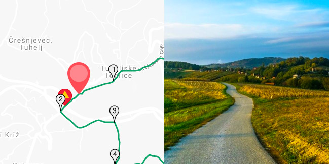
Through the picturesque Hills and Valleys
This short cycling route will take you through the area south of Tuheljske Toplice (Tuhelj spa resort) and the picturesque valley of the stream Bezavina to the manor Vižovje and further through the valley of the river Horvatska.
Range Zagorske županijske rute |
Length 22km |
Difficulty 2/5 |
Elevation 207m |
Surface 100% asfalt |
Vranyczany Route
This cycling route, full of viewpoints and wonderful nature, begins in the center of Sv. Križ Začretje. At the beginning or at the end of the ride, be sure to visit the complex of the castle Vranyczany.
Range Zagorske županijske rute |
Length 47.5km |
Difficulty 4/5 |
Elevation 580m |
Surface 100% asfalt |
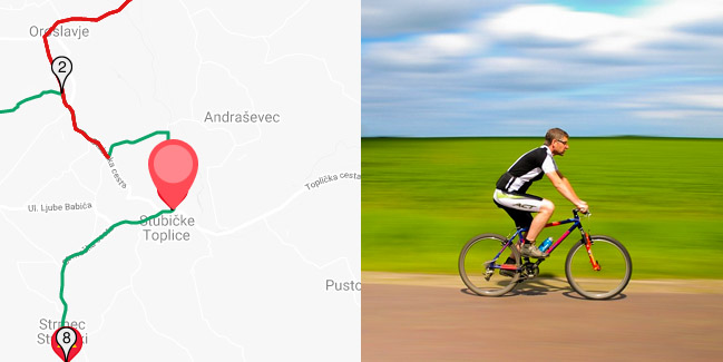
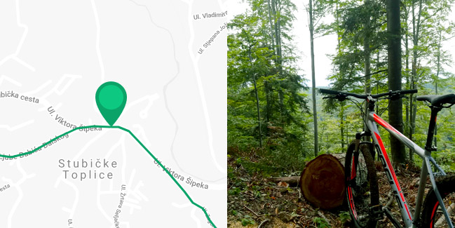
Through the Surroundings of Stubičke Toplice
This short and light recreational cycling route will take you through the area of Stubičke Toplice, Stubička Slatina and Kraljev Vrh.
Range Zagorske županijske rute |
Length 20km |
Difficulty 1/5 |
Elevation 240m |
Surface 100% asfalt |

Through Oroslavje along the Valley of the River Krapina
The route begins in the beautiful park of the castle Oroslavje, where you start towards the village of Bračak. Drive carefully in the first part of the route until the railway line.
Range Zagorske županijske rute |
Length 30km |
Difficulty 3/5 |
Elevation 430m |
Surface 100% asfalt |
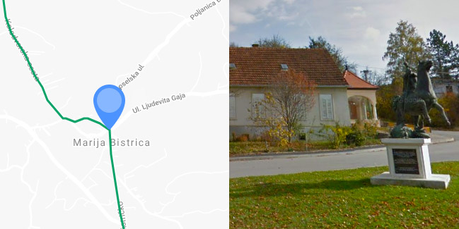
Roads of Seljačka buna (Peasants’ Revolt)
This cycling route is very significant because it connects some of the most significant sites of the southeastern Zagorje, such as Peasants’ Revolt Museum and the Marian shrine in Marija Bistrica.
Range Zagorske županijske rute |
Length 36km |
Difficulty 3/5 |
Elevation 550m |
Surface 100% asfalt |
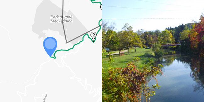
Through the Nature Park Medvednica and Stubica region
Extra hard route! This cycling route will lead you through the northeastern part of the nature park Medvednica and the picturesque hills of Stubica region. The route is very difficult and only good mountain bikes should be used. Most of the parts of the route are marked with hiking marks.
Range Zagorske županijske rute |
Length 50km |
Difficulty 5/5 |
Elevation 1460m |
Surface asfalt / makadam / zemlja |
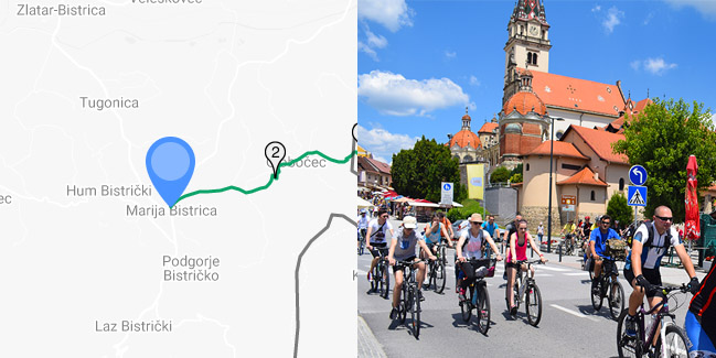
From Marija Bistrica to Zelina
This is a very short and easy cycling route, which will take you from Marija Bistrica to Zelina in the Zagreb County. When you come near Zelina, you can continue the ride down the cycling routes of the Zagreb County. One-way route.
Range Zagorske županijske rute |
Length 18km |
Difficulty 1/5 |
Elevation 350m |
Surface 100% asfalt |
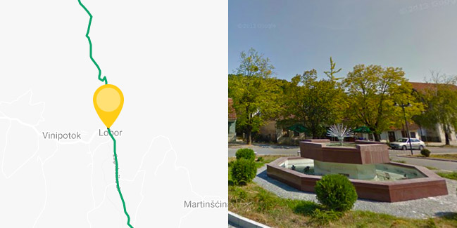
Through the Surroundings of Lobor and western Ivanščica
The cycling route begins in the center of Lobor. Continue towards north in direction of Stari Golubovec. The route goes over the asphalted road with less traffic, along the stream Reka.
Range Zagorske županijske rute |
Length 31km |
Difficulty 3/5 |
Elevation 390m |
Surface 100% asfalt |

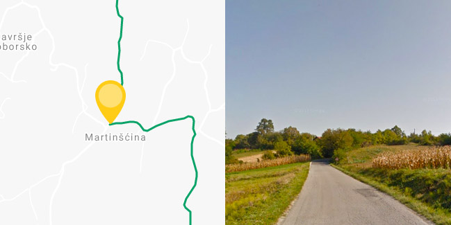
Along the Castles, Manors and Hills of in the Heart of Zagorje
The cycling route begins in the center of Zlatar, where you must take the Varaždinska Street towards north and the village of Martinšćina. The road from here is peaceful. Pass through the village of Borkovec to the Y intersection with crucifix, where you must turn left towards Martinšćina.
Range Zagorske županijske rute |
Length 49km |
Difficulty 4/5 |
Elevation 400m |
Surface 100% asfalt |
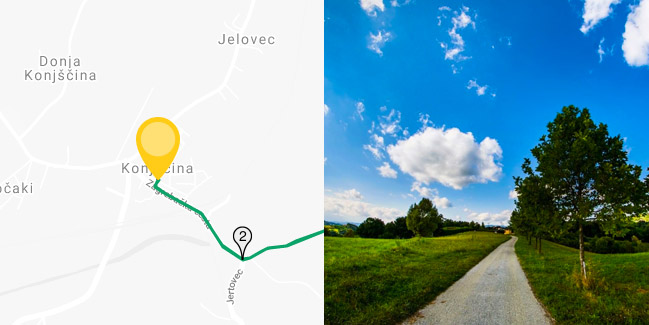
Down the hills, valleys and belvederes of northeastern Zagorje
Start the ride in the center of Konjščina. Do not worry if you arrive by car, because there are enough parking lots. From the center of Konjščina, start riding towards southeast over the railway lines to the Y intersection.
Range Zagorske županijske rute |
Length 42km |
Difficulty 4/5 |
Elevation 480m |
Surface 100% asfalt |
Over the Slopes of Ivanščica
Extra hard route! The cycling route will take you over the southern slopes of Ivanščica and picturesque hills through the villages of Belec and Gornja Batina. The route is very difficult and only good mountain bikes should be used. Descent from Ivanščica is especially difficult because of the demanding terrain. That is why we recommend everybody to use – when returning from the peak of Ivanščica – the same road they came from.
Range Zagorske županijske rute |
Length 27km |
Difficulty 5/5 |
Elevation 930m |
Surface asfalt / makadam / zemlja |
The Gubec Country
Jedina ruta koju su trasirale lokalne turističke zajednice u Županiji u duljoj je varijanti duga 42, a u kraćoj 34 km. Povezuje gradove Oroslavje i Donju Stubicu te općine Stubičke Toplice i Gornja Stubica u Stubičkom ‘Gupčevom’ kraju.
Range Zagorske županijske rute |
Length 42km |
Difficulty 5/5 |
Elevation 1300m |
Surface Pretežno asfalt |