Find the route for you

|

|

|

|

|

|

|

|

|

|

|

|
RANGE Zagorje routes |
TYPE Line |
LENGTH 18km |
SURFACE 100% asphalt |
DIFFICULTY 1/5 |
POSITION south-east |
MARKS State-level |
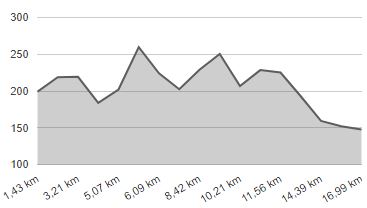
ELEVATION 350m |
LOWEST POINT 150m |
HIGHEST POINT 280m |
From Marija Bistrica to Zelina
Marija Bistrica - Žitomir - Sv.Ivan Zelina

This is a very short and easy cycling route, which will take you from Marija Bistrica to Zelina in the Zagreb County. When you come near Zelina, you can continue the ride down the cycling routes of the Zagreb County. Parts of this route merge with the routes of TZO (Tourist board) of the Municipality of Marija Bistrica. Note: this is a one-way route of length of 18 km in one direction.
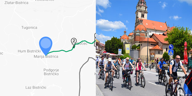
Start the ride at the central square in Marija Bistrica 1 in front of the shrine of Majka Božja Bistrička (Our Lady of Bistrica). There are many parking lots nearby. From the main square, continue along the Ljudevit Gaj Street towards Zelina. Although the route is easy, in Zagorje you cannot avoid the hills, not even on this route. The first steeper ascent begins at 2,5 km from the start and it will lead you to the Y intersection 2 with crucifix, where you must turn left and continue downhill. Continue riding through a picturesque valley down the road with less traffic. In the village of Cecili (5,7 km from start), at the Y intersection 3, keep left and continue downhill. The ride continues through Žitomir and Prepolno until the T intersection 4(9,7 km from start), where you must turn right towards the center of Gornje Orešje. To the left, the road to Konjščina branches off. In the center of Gornje Orešje, you can take a break at the local coffee house. However, if you are in a hurry, you can continue to the intersection 5 with a shrine, where you must turn right and continue uphill. As you climb, the space in front of you will open up and you can enjoy the view of the surroundings.
From this point on, the route leads you over a more flat terrain, and there are no major hills. Ride through the village of Donje Orešje and – at the intersection 6 (14,8 km from start) – you must continue straight forward. Slowly you are getting closer to Zelina and at the intersection 7 (16,4 km from start) turn right uphill. The intersection can be easily missed, so be careful. At the next intersection 8 with Toplička Street, turn left to the intersection 9. At the intersection, carefully turn right into the Vladimir Nazor Street and continue carefully towards the center of Zelina. After the intersection, you can continue riding on the sidewalk, for safety reasons. After 18 km of the ride, you will reach the center of Zelina, where you can rest and prepare for the ride back to Marija Bistrica, using the same route.
One of possible routes for going back is the road through Zelingrad and Kladešćica, but this road is exclusively for mountain bikes, because the descent from Kladešćica towards Marija Bistrica is extremely technically challenging and in certain sections even dangerous.
Technical description
- Start of the route in the center of Marija Bistrica. Continue along the Ljudevit Gaj Street towards Zelina.
- Y intersection with crucifix. At the intersection, continue left downhill.
- Y intersection. At the intersection, you must turn left and continue downhill.
- T intersection, continue to the right slightly downhill. The road on the left leads to Konjščina.
- Y intersection with a shrine. At the intersection, continue to the right uphill towards Zelina.
- Intersection, continue straight.
- Caution. Y intersection, turn right uphill. The intersection can be easily missed.
- Y intersection, turn left and continue along the Toplička Street.
- Caution. Y intersection, turn right and continue carefully uphill. If needed, you can ride on the sidewalk, for safety reasons.


