Find the route for you

|

|

|

|

|

|

|

|

|

|

|

|
RANGE Local routes |
TYPE Circular |
LENGTH 5.9km |
SURFACE 100% asphalt |
DIFFICULTY 2/5 |
POSITION north-west |
MARKS Local |
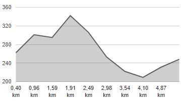
ELEVATION 140m |
LOWEST POINT 209m |
HIGHEST POINT 345m |
Radoboj – The Quiet Route
Radoboj - Gorjani Sutinski - Gornja Šemnica - Radoboj

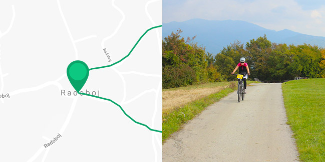
The ‘Quiet’ Route, located at the foot of Strahinjčica, is a circular type route in the shape of a triangle with 2-kilometre long sides. It passes through a beautiful hilly landscape full of vineyards with views of a large part of the County. It starts in the municipal seat of Radoboj, from where it climbs a sharp hill, 90 metres up towards Gorjani Sutinski. After that, the route curves to the right and runs downhill, south to Gornja Šemnica, where it turns right and north again up a slight incline to the starting point in Radoboj. The route is 6 kilometres long, which in its entirety includes paved roads; there is 4 km spent cycling on quiet local roads with little motor traffic, with the remaining 2 km overlapping with the wider and slightly busier county road Krapina – Gornja Šemnica.


