Find the route for you

|

|

|

|

|

|

|

|

|

|

|

|
RANGE Local routes |
TYPE Line |
LENGTH 10.8km |
SURFACE 100% asphalt |
DIFFICULTY 1/5 |
POSITION north-west |
MARKS Local |
ELEVATION 210m |
LOWEST POINT 188m |
HIGHEST POINT 285m |
Zagorska Sela Uphill and Downhill
Miljana - Bratkovec - Harina Žlaka - Poljana Sutlanska - Miljana

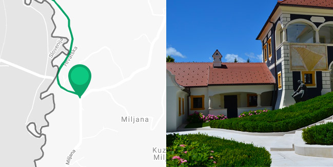
The ‘Uphill and Downhill’ Route starts in the picturesque town of Miljana near the famous castle near the border with Slovenia and leads north, along the valley of the river Sutla.
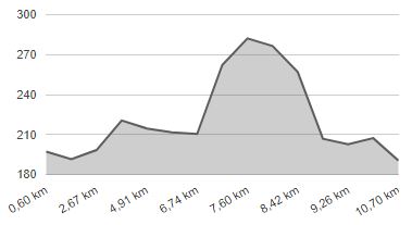
After 1.5 km of cycling northwards, on a quiet road along the Sutla, the route forks in two directions. If it is your first time, we recommend the easier variant to the left along the Sutla via Bratkovec on mostly flat terrain. The routes converge again after 2.8 km in Luka Poljanska and continue north together for another 1.3 km north, to the village of Harina Žlaka, which is near the local border crossing to Slovenia. Here you should turn back and make a sharp left turn ‘uphill’ in Luka Poljanska, taking the 600 metres shorter, but markedly more challenging route to Miljana instead of continuing straight along the river.
The difference in elevation is 80 metres, and due to the steep climb, it will be necessary to push the bike a bit. It will be worth the trouble – at the top of the hill, there are beautiful views of the valley of the Sutla and the surrounding hills to enjoy. The following slope leading ‘downhill’ the valley of the Sutla is just as steep. After 1.5 km of the same route, you return to where you started from, Miljana. The entire length of the route is on paved, quiet narrow roads with minimal motor traffic.


