Find the route for you

|

|

|

|

|

|

|

|

|

|

|

|
RANGE Local routes |
TYPE Circular |
LENGTH 20.8km |
SURFACE 100% asphalt |
DIFFICULTY 3/5 |
POSITION Mix |
MARKS Local |
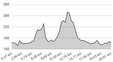
ELEVATION 390m |
LOWEST POINT 151m |
HIGHEST POINT 274m |
Tuhelj – Roads of the Two Springs 2
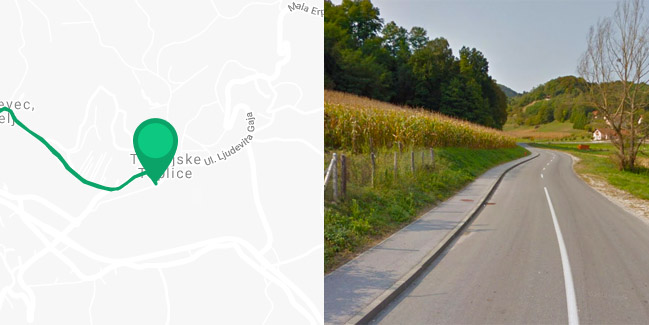
Tuheljske Toplice - Črešnjevec - Tuhelj - Prosenik - Dugnjevec - Pristava - Tuhelj - Tuheljske Toplice

Visitors to Tuheljske Toplice are free to enjoy another beautiful, if slightly more challenging route, called ‘Roads of the Two Springs 2’. The first part of the route, a 3.5-km-long section from Tuheljske Toplice to the municipal centre of Tuhelj, is shared, with the first 2 km following a quiet local road along the river Horvatska, and the remaining 1.5 km a slightly busier county road to Desinić. In Tuhelj, the route forks in two directions to the west and north; if you continue to the north, though, the route goes along the road to Desinić for another 1.5 km, and then turns onto a quiet local road towards Prosenik. Here a gradual ascent to Dugnjevec awaits you, with a difference in elevation of 110 meters, at a height of 274 meters above sea level. In Lenišće, the route turns downhill to the right and then left down a special turnoff to the beautiful Chapel of St. Margaret and back – if you don’t want to take this path, the route is shorter by 2.5 km. From Prosenik via Lenišće and Dugnjevec to Ravno Brezje, for 7 kilometres the route goes along a picturesque hill ridge with beautiful views in all directions, and then descends sharply into the Tuhelj spring valley. Upon arrival in Pristava, the route meets the county road Kumrovec – Tuhelj and after 1 km loops back to Tuhelj and continues on to Tuheljske Toplice the same way as at the beginning. Just like the ‘Roads of the Two Springs 1’ Route, this route is also entirely on paved roads and for the most part sticks to picturesque narrow local roads with little motor traffic.


