Find the route for you

|

|

|

|

|

|

|

|

|

|

|

|
RANGE Local routes |
TYPE Circular |
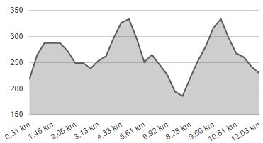
LENGTH 12.8km |
SURFACE Mostly asphalt |
DIFFICULTY 3/5 |
POSITION south-east |
MARKS Local |
ELEVATION 610m |
LOWEST POINT 179m |
HIGHEST POINT 336m |
Marija Bistrica – Route 3
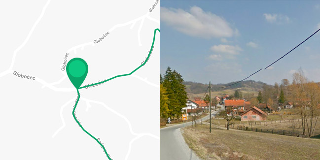
Globočec/Kovačići - Petrici - Prugovečki - Hanžeki - Globočec/Kovačići

The starting point of Route 3 is in the hamlet of Kovačići, 1.5 km east of Marija Bistrica. The route then turns south across a picturesque local paved road. For the first two kilometres, it follows the same path as Route 1; only this time, we go uphill with an elevation difference of 100 metres, to the hamlet of Kruhaki, which is followed by a ride down a steep incline for 600 metres, along a dirt road. Upon reaching the valley at the foot of Medvednica, turn left onto a gravel road and ride for about 1.5 km, and then make another sharp left turn uphill and ride for 400 metres (altitude difference 60 metres). This part includes a dirt road suitable only for mountain bikes. Continue until you reach the hill near the hamlet of Petrici. Once atop of the hill, you can return to the County Road Marija Bistrica – Zelina if you go left, cross 900 metres of a relatively good gravel road and a slight downhill incline. Otherwise, you can continue straight ahead for 350 metres along a dirt road, down a very steep incline. This is followed by a 1.6 km ride downhill on the local paved road, all the way to the county road to Marija Bistrica. If you’d prefer a shorter version of Route 3 (only 8 kilometres long), turn left towards Marija Bistrica and ride for 900 metres, back to the starting point of the route.
However, if you want to experience all the sections of Route 3, turn right and ride downhill for 900 metres along the County Road to the hamlet of Hanžeki, and there turn right onto another picturesque local road towards the slopes of Medvednica. This part of the path is two kilometres long and has an ascent of 150 metres. The last 500 metres of the route follows a rough and steep gravel road leading to the top of the hill near the hamlet of Petrici – same as with the shortened route; thus, getting back to the starting point remains the same. The longer variant of Route 3 is 12 km long and – on account of several steep sections on dirt roads – it is not passable in rainy weather or when the road is muddy. In fact, even in normal conditions, it is recommended only for cyclists using mountain bikes.


