Find the route for you

|

|

|

|

|

|

|

|

|

|

|

|
RANGE Local routes |
TYPE Circular |
LENGTH 6.5km |
SURFACE Mostly asphalt |
DIFFICULTY 2/5 |
POSITION south-east |
MARKS Local |
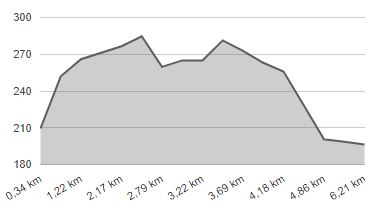
ELEVATION 190m |
LOWEST POINT 187m |
HIGHEST POINT 286m |
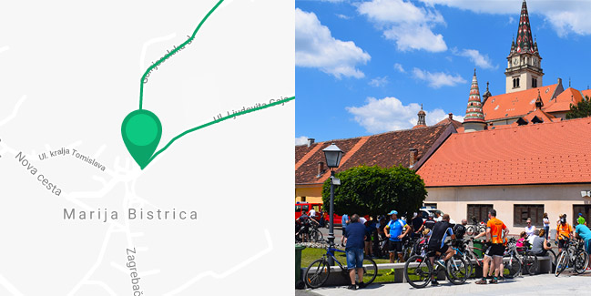
Marija Bistrica – Route 2
Marija Bistrica - Poljanica Bistrička - Vinski vrh - Hunjaki - Gleci - Globočec/Kovačići - Marija Bistrica

The Cycling Route 2 also begins in Marija Bistrica but goes north, along the county road to Konjšćina. The 2.8-km long first section of the route follows a moderately busy road on a slight uphill incline via Poljanica Bistrička to the Vinski Vrh sanctuary. The route then takes a sharp turn to the right, southwards, onto a quiet and picturesque local road towards the hamlet of Gleci. For the first 800 metres, you’ll be riding on a well-constructed gravel road, and the next 1.4 km of the route to the hamlet Kovačići is a paved road that passes numerous traditional vineyard homes (“kleti”) with many an amazing view of the surrounding wine-growing hills. The last 1.5 km is the same as the Route 1, stretching along the county road Marija Bistrica – Zelina.


