Find the route for you

|

|

|

|

|

|

|

|

|

|

|

|
RANGE Local routes |
TYPE Circular |
LENGTH 8km |
SURFACE Mostly asphalt |
DIFFICULTY 2/5 |
POSITION south-east |
MARKS Local |
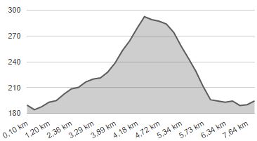
ELEVATION 180m |
LOWEST POINT 184m |
HIGHEST POINT 297m |
Marija Bistrica – Route 1
Marija Bistrica - Ozimci - Podgorje Bistričko - Kruhaki - Globočec/Kovačići - Marija Bistrica

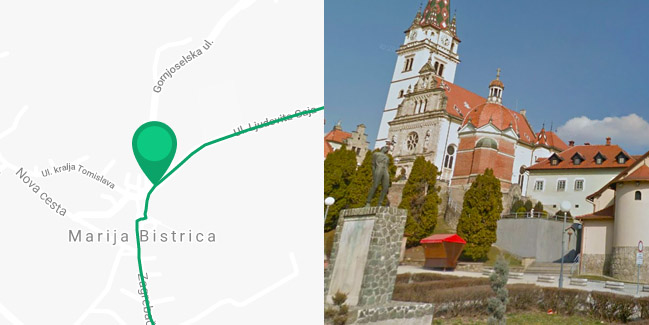
Route 1 starts in the centre of Marija Bistrica, on Pope John Paul II Square, leading downhill to the south for 200 metres along the pedestrian zone, then 200 metres down Zagrebačka Street. Lastly, it turns left onto a local paved road along the Bistrica stream valley up a slight incline towards Podgorje Bistričko. At the 3-km mark from the start, there is a section that follows a gravel road for 800 metres, after which you need to make a sharp left turn. It is followed by a very steep incline for 800 metres with a difference in elevation of 70 metres, before reaching the hamlet of Kruhaki, along a dirt road which is only passable for mountain bikes. This is followed by a 1.6-km ride downhill along a quiet local paved road through a picturesque hilly landscape to the hamlet of Kovačići, where you need to turn left onto the county road to Marija Bistrica. The last two kilometres pass through the somewhat busier and mostly flat county road Marija Bistrica – Zelina.


