Find the route for you

|

|

|

|

|

|

|

|

|

|

|

|
RANGE Local routes |
TYPE Circular |
LENGTH 12.7km |
SURFACE 100% asphalt |
DIFFICULTY 3/5 |
POSITION north-west |
MARKS Local |
ELEVATION 410m |
LOWEST POINT 310m |
HIGHEST POINT 502m |
Jesenje – Route 2
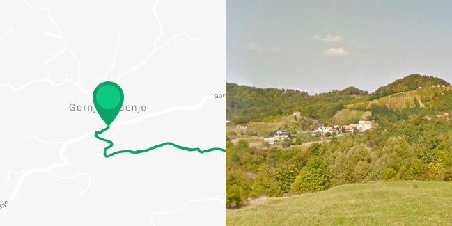
Gornje Jesenje - Šturnjaki - Flaši - Cerinski - Šaški - Šturnjaki - Gornje Jesenje

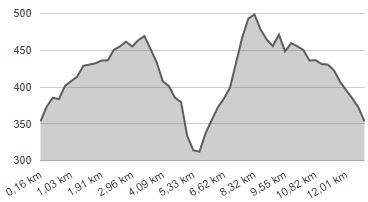
Route 2 also starts in the town centre of Gornje Jesenje, with a short section that extends west, then turns south and continues for 3.7 km up a long and at times quite sharp incline to the village of Brdo Jesensko (difference in elevation of 120 metres). After leaving the village, the route splits off in two separate directions. Here you should turn right, head south-east, down a steep incline, with an altitude difference of 160 metres. After a 2-km long descent, you will reach the valley of the Presečina stream, with only 700 metres remaining to the end point of the ‘Roman Road’ Route from Radoboj. Upon arrival in the valley, turn left towards Gornji Šaški, where you’ll have to ride uphill for 2.7 km, starting from 310 metres and climbing all the way up to 500 metres above sea level, which is the highest point of all local routes in the County. This is followed by a 700-metre gentle downhill ride to the junction with the common part of the route and then a 3.7 km ride to Gornje Jesenje, this time downhill. The Jesenje Route 2 also follows paved narrow local roads with very little motor traffic, and owing to the high altitudes and lush forests, the atmosphere feels like the Alps. However, given the large altitude difference in relation to the total mileage, this is also the most demanding of all the local routes in the County.


