Find the route for you

|

|

|

|

|

|

|

|

|

|

|

|
RANGE MTB/Gravel rute |
TYPE Kružna |
LENGTH 31.6 |
SURFACE asfalt / makadam / zemlja |
DIFICULTY 3 |
POSITION sjeveroistok |
MARKS Oznake na državnoj razini |
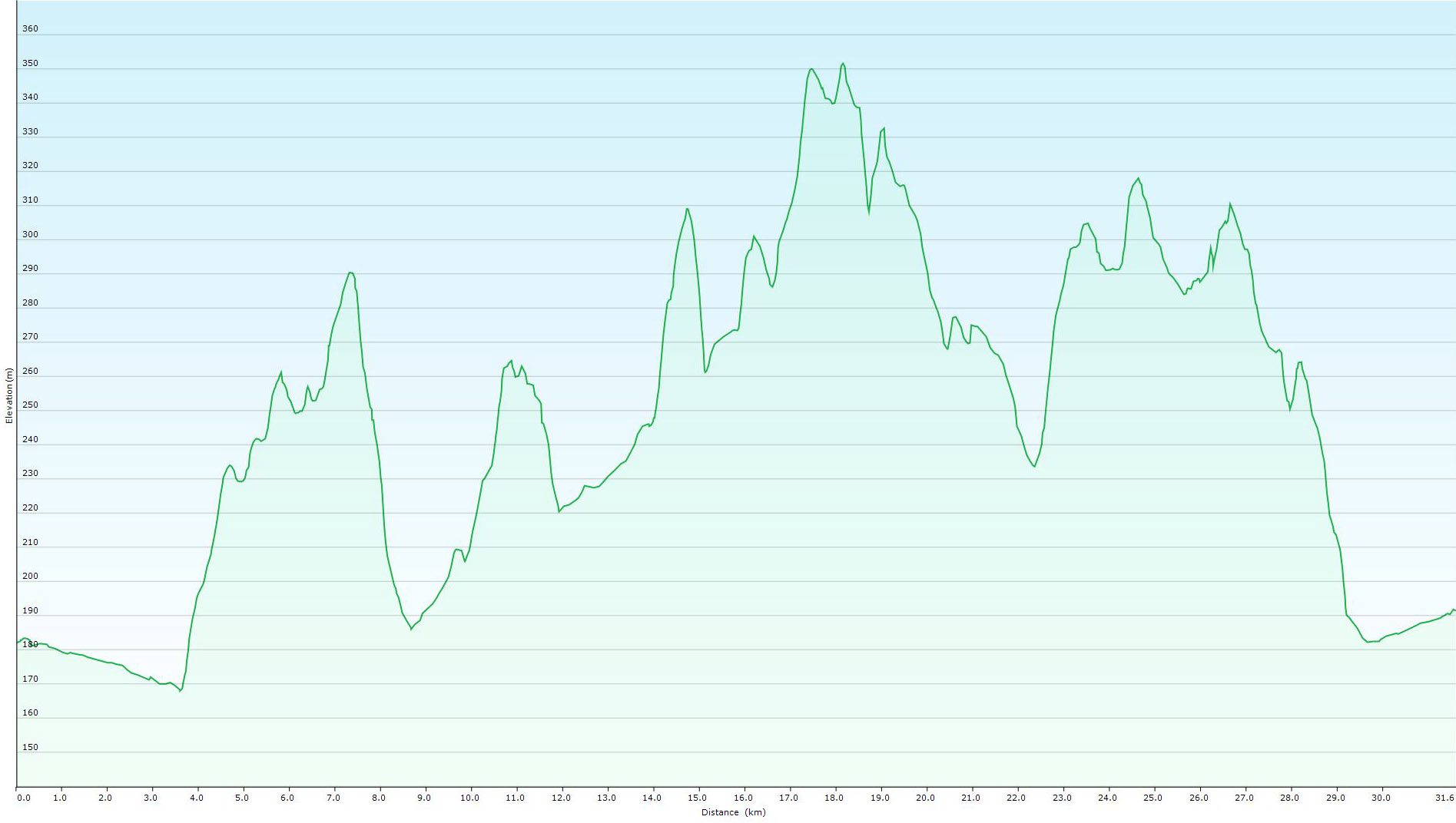
ELEVATION 619m |
LOWEST POINT 168m |
HIGHEST POINT 352m |
The Laterna Magica Route – Zlatar

The earliest known mention of the town’s name is the Zlahtaria estate, which was owned by the Bedeković family at the end of the 13th century. Zlatharia is the Latin form of the Croatian word Zlatar. However, the original form of the name of today’s Zlatar, as it was pronounced by the people who lived there at the time, was Zlatarjeva or Zlatarjevo. In the 19th century, Zlatar fully established itself as the administrative, political, economic and cultural centre of the entire region.
In his book “Laterna Magica”, the writer Slavko Batušić described his childhood days in Zlatar, spent at the beginning of the 20th century. The book gives a detailed account of what the City looked like at that time, and what the culture and way of life were like. Read the book, hop on your bike and experience Zlatar in your own way, while thinking about how things were at the beginning of the 20th century.
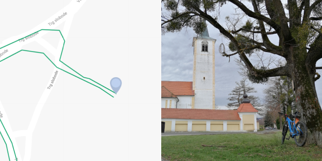
You start the route in the very centre of Zlatar, in the parking lot in front of the Zlatar Municipal Court building. As you leave the town, you will pass two roundabouts. At the first roundabout, take the 2nd exit, which should lead you to the next roundabout, where you need to take the 1st exit. Ride south on Martinečka Street towards Lovrečan. Upon reaching point Z1, turn right off the paved road onto the gravel road and follow the slight uphill section in the shade all the way to the Z2 T-junction. Continue to the right, towards the forest, and ride past the vineyards, traditional vineyard houses, with a view of the hills. You have to ride down a gravel road to the Z3 intersection. Turn left onto the downhill section, but ride carefully because it won’t take you long to reach the Z4 intersection, where you need to make a sharp turn to the right. This will take you back on a paved road which you should follow to the T-junction with the main road between Mače and Zlatar. Z5 turn right, ride to the top of the Z6 uphill section, and turn left with maximum caution. Ride for 200 m, Z7 turn left towards the uphill section and the local road. The next section is a quite long climb uphill, but you should make your way to the top with ease, while enjoying the view of the Ivanščica mountain. At the Z8 intersection, turn right, then follow the road to the Z9 junction onto the main road between Lobor and Zlatar. Continue towards Lobor, 2.0 km on the main road. Intersection Z10 takes you to the right towards Završje Loborsko. This is followed by an uphill section over the next 500 m. When you reach the top, you will be surrounded by spectacular vistas in all directions, encompassing the Zagorje region as a whole; any sign of fatigue will then disperse. At the top, turn left and follow the road to Martinščina. You will find yourself in the town centre of Martinščina, Z11, with the Chapel of St. Martin. The route extends right towards an uphill section that is not long. Ride down to Z12 and turn left. As you ride to the north, you’ll see Ivanščica getting closer, and the ride is pleasant, with beautiful landscapes. At the intersection in the middle of the hamlet of Repno, Z13, you will find yourself closest to Ivanščica, at a location that will allow you to see the ruins of the old town of Belecgrad, which still stands proudly on top of a steep cliff. Continue right towards the east and the hamlet of Juranščina. Intersection Z14 takes you to the right towards Belec. You will find yourself at the Z15 intersection, the village of Belec and the Church of St. Mary of the Snows, which has been lauded as one of the most beautiful baroque churches in Croatia and beyond. Continue past the church on the right, westwards, and you will reach the Z16 T-junction. Turn left onto a gravel road and enjoy a ride downhill, one that goes all the way to the intersection in Gornja Batina. Z17 Turn right and cross the watercourse, then immediately turn left onto the uphill section towards the village of Znož. At this point, you’ll already have a view of Medvednica from afar. At Z18, turn right onto the Brezice wine road, ride and enjoy the next 2.2 km. In this section, you will be riding along the street which was named after the author of the book “Laterna Magica”, the Slavko Batušić Street.
Stop for some refreshments at Stara Hiža Čibi and return invigorated back to the route’s starting point. Z19 Turn right and continue along Vinogradska Street with a breathtaking view of Zlatar. Point Z20 takes you to the right and further along the ridge above Zlatar. At a larger X-junction, Z21, turn right and you’ll find yourself at the T-junction with the main road between Zl. Bistrica and Zlatar, Z22.
Turn right and ride for 2.4 km until you reach the starting point of the route in the town centre of Zlatar.
The route is ideal for MTB/Gravel/trekking bikes, and you can easily and effortlessly ride an e-bike, as well. Stronger physical fitness and advanced cycling skills are a must.
For additional information, contact the Zlatar Tourist Board.
For a safe and carefree ride, study the map and all the necessary information or hire a local licensed cycling guide. A list of active and licensed guides can be found here.
Technical description
Route start/endpoint: The route starts and ends in the parking lot in front of the Zlatar Municipal Court building. We head in the direction of the Church and the roundabout in the very centre of Zlatar.
- Turn right. The beginning of the gravel road. Climb.
- T-junction with the paved road. Turn right and continue towards the forest.
- Y-junction. Turn left onto the forest road.
- Make a sharp left turn. Paved road, downhill.
- T-junction with the main road. Make a right turn towards the mild uphill section.
- Intersection at the very top of the uphill section. Turn left onto the side road.
- After the fence on the left, turn left onto the uphill section along the local road.
- T-junction. Turn right.
- X-junction with the main road. Turn left in the direction of Lobor. 2.0 km to the next intersection.
- Y-junction. Turn right, towards Završje Loborsko. After 90 m, turn right onto the 500-m-long uphill section, and then turn left at the top.
- Y-junction near the Chapel of St. Martin. Make a right turn towards the rising slope.
- T-junction. Turn left. There’s a Y-junction after 260 m – turn right.
- Y-junction. Turn right. Careful, narrow road.
- T-junction. Turn right, towards the centre of Belec.
- Large junction in front of the Church of St. Mary of the Snows in Belec. Make a right turn westward.
- Y-junction. Turn left. The beginning of the gravel road.
- CAUTION! Y-junction with the main road. Turn right, then immediately left onto the uphill section.
- T-junction. Turn right onto the Brezice wine road, which you should follow for the next 2.2 km.
- Intersection. Turn right. On the left side you will find the ‘Stara Hiža Čibi’ boarding house.
- Y-junction. Turn right and uphill.
- Intersection. Turn right and go down Vinogradska Street to the main road.
- T-junction with the main road. Turn right onto the main road. This is followed by a 2.5 km ride to the starting point of the route.


