Find the route for you

|

|

|

|

|

|

|

|

|

|

|

|
RANGE Local routes |
TYPE Line |
LENGTH 15.5km |
SURFACE 100% asphalt |
DIFFICULTY 1/5 |
POSITION south-west |
MARKS Local |
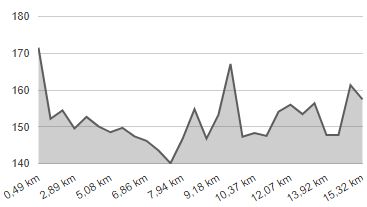
ELEVATION 160m |
LOWEST POINT 140m |
HIGHEST POINT 172m |
Krapinske Toplice and Tuhelj – Roads of the Two Springs 1
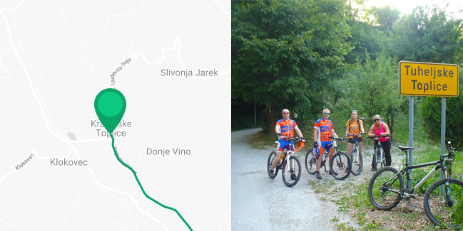
Krapinske Toplice - Vrtnjakovec - Viča Sela - Jalšje - Vilanci - Tuheljske Toplice

If you are staying in Krapinske Toplice or Tuheljske Toplice, and you are not a fan of overly strenuous cycling trips, here you have a chance to take a unique and, in terms of Zagorje, almost completely flat line route. It meanders through the gentle valleys of the Zagorje rivers Kosteljina and Horvatska, following the local paved roads in its entirety. If you start from Krapinske Toplice, the route extends 1.5 km to the south on a local road, which is slightly busier with all the traffic entering Toplice. It then continues straight down a quiet road through the Kosteljina valley. After 5 km in Viča Sela, the route turns right across the state road D-507 to Jalšje and continues west along the valley of Horvatska to Tuheljske Toplice. After a 7-km ride, the route turns first to the left when you reach Vilanci and then – past the junction on the road D-205 – to Tuheljske Toplice to the right. The last 1.5 km is again a bit busier in terms of traffic on account of its vicinity to Toplice, even if traffic in general is pretty slow here because of vehicles entering the most popular Zagorje thermal resort with numerous entertainment facilities.


